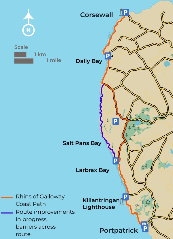


#02 / 06
Corsewall
to
Portpatrick
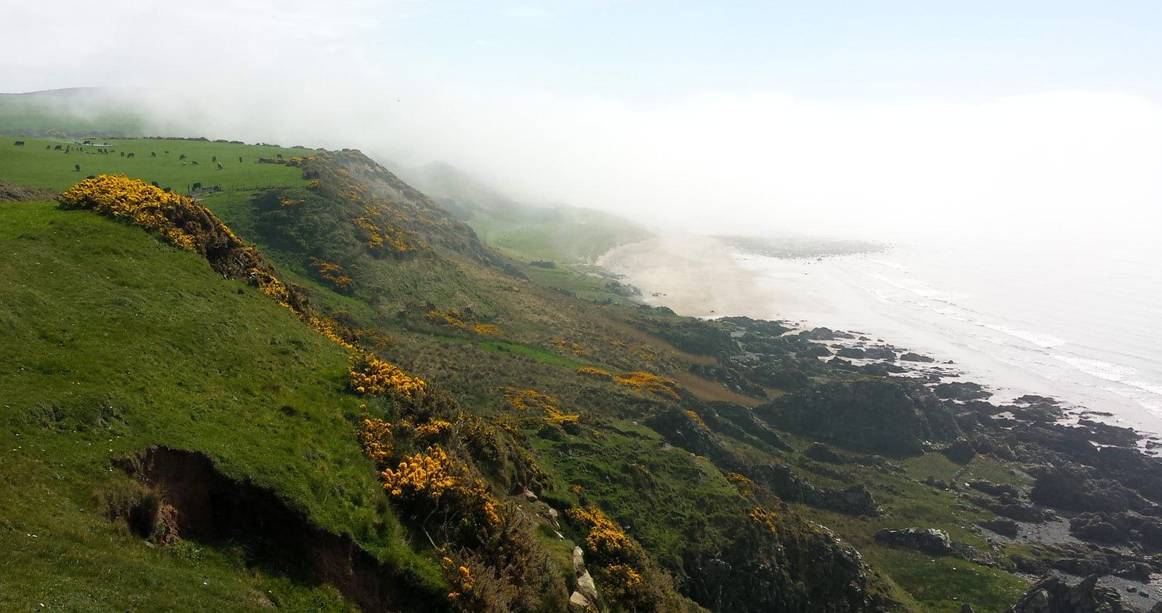
On this section, starting from the lonely lighthouse at Corsewall Point, you will experience the wildness of a coastal fringe where the land meets the sea.
Abandoned buildings and wide open beaches add to the remote character of this stretch of coast until you arrive at your destination, the busy seaside town of Portpatrick. On the rugged north western coast of the Rhins you will see nature at its wildest, where nature has adapted to thrive in a salty environment the rocky shores remain largely untouched by development. Clues in the landscape uncover surprising stories and little known history; forts and fairies, saltpans and a radar station, all are revealed as you walk this route.


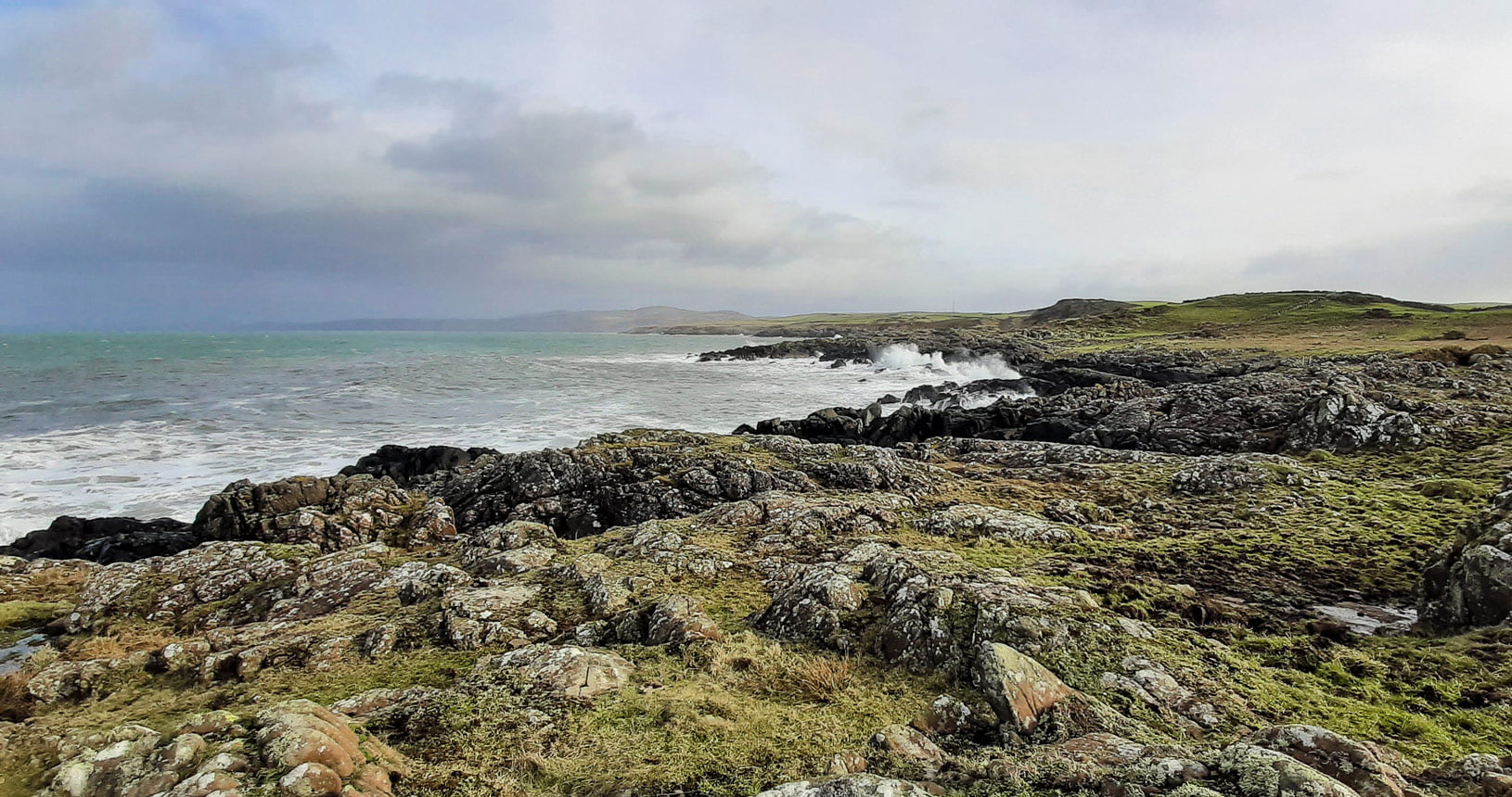
This rocky shore is the home to a herd of wild goats, probably abandoned by farmers hundreds of years ago. Beaches are a regular haunt for grey seal and they can often be seen hauled out on their favourite rock at low tide.
In the summer black guillemots are a frequent sight. Guillemots are easy to recognise with their unmistakable white wing patches on an all-black body. Usually nesting under boulders at the base of cliffs they are particularly noticeable in Portpatrick where they nest in holes on the harbour wall.
the grey seal is very inquisitive
The larger of two seals found in Scottish waters, the grey seal, is very inquisitive and you will see their distinctive long muzzle as they watch you pass by. The route hugs the coast taking you past Broadsea and Knock Bay which reveal their long sandy beaches at every low water. If you are tempted to wander down to the sea remember to keep an eye on the incoming tide!
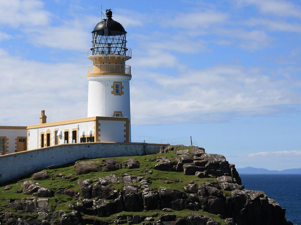
Killantringan Lighthouse no longer has a working light but remains as a photogenic landmark on Black Head promontory. Here you join the popular coastal section of the Southern Upland Way along the cliff top before dropping into the sheltered harbour at Portpatrick.
Dunskey Glen
From Portpatrick a circular walk follows the Southern Upland Way along a dramatic cliff top walk, past a sandy bay at Port Mora (known locally as Sandeel Bay) to Port Kale (known locally as Laird’s Bay) where a distinctive white cable house is located. From here you leave the Southern Upland Way and head inland through the wooded glen and return to Portpatrick.

North West Coast
Codename Chain Home
Close to Corsewall are the remains of brick buildings and bunkers that were once part of a chain of secret coastal radar stations. Built by the RAF at the beginning of World War 2 it provided the first early warning air defence system.
Ebbstone beacon
Many ships have come to grief on the Laggan or Ebbstone Rocks – a sunken reef north of Dally Bay. In the 1850s a beacon was erected to warn ships of the danger and today only the concrete base can be seen off shore. In the early hours of the morning of 28th May 1856 the steam ship Princess Royal was running at full speed between Liverpool and Greenock when suddenly out of the fog loomed the beacon. The ship ploughed into the rocks but fortunately all 200 passengers and crew were saved.
On the rocky foreshore is a curious cairn of chalk boulders. The mostly likely explanation seems to be that the chalk was surplus material imported from Northern Ireland to be processed in nearby limekilns for agricultural use.
Coastal castles and forts
Take a look at your map and you will see a string of Iron Age promontory forts marked along the coastline. These ancient fortifications can be identified by their defensive ditches, although some are more obvious than others. Castle Ban, south of Dally Bay, is a medieval motte – a steep sided mound on which a castle once sat. Many forts are linked to local superstitions and, like many others, Castle Ban is reputed to be haunted by fairies.
Seeing double
In Port Kale is a white double octagonal building that housed telegraph cable connections. Built in 1852, it is located at the Scottish end of the first successful cable laid across the Irish Sea. About forty years later another cable was laid that required new housing. Echoing the original building an extension was built to create the building you see today. The connection has now been abandoned and redundant cable can still be seen exposed on the shore.


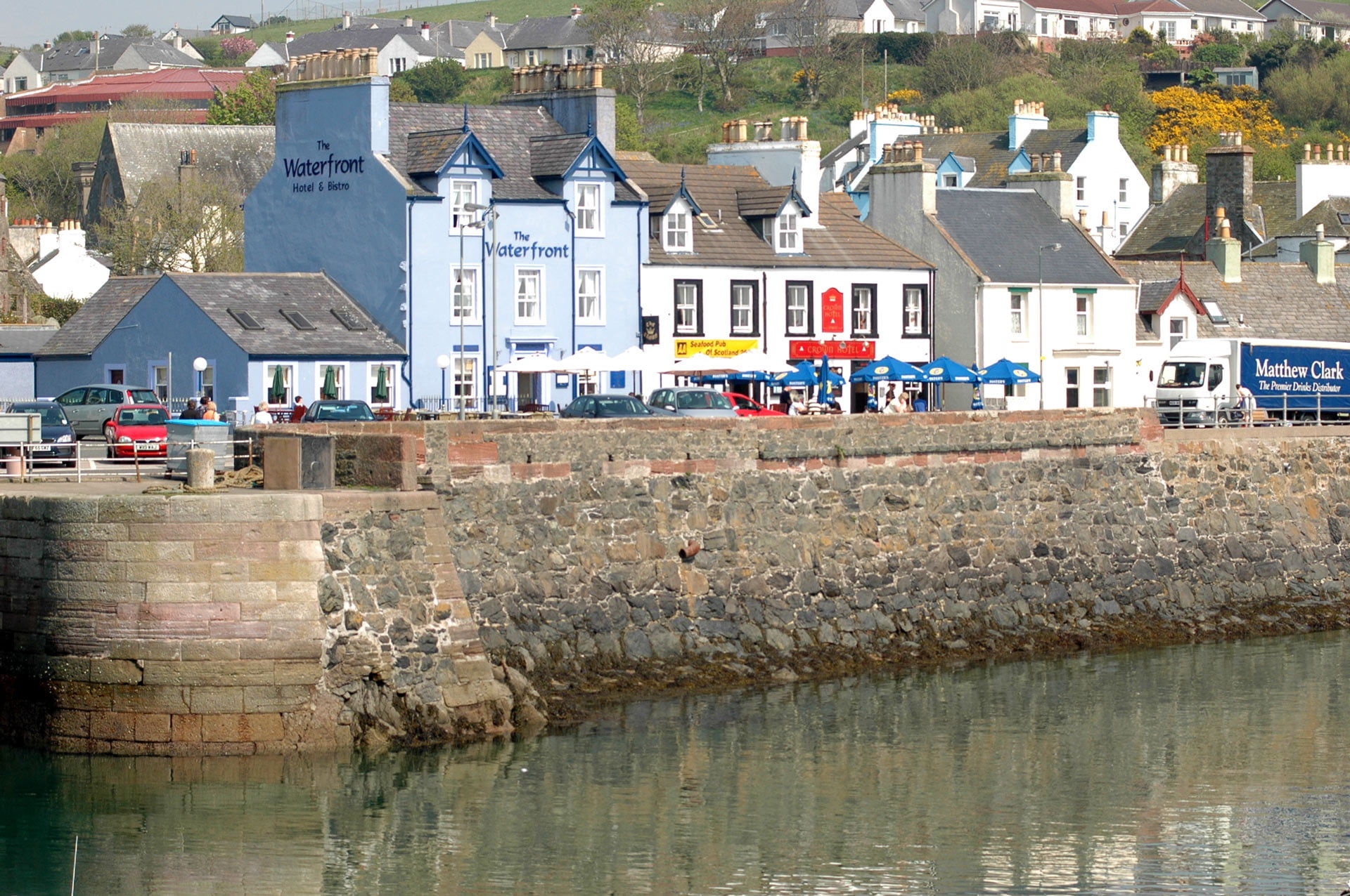
Portpatrick
This section ends here in Portpatrick,
nestled in a bay on the West Coast.
Portpatrick
Your destination for this section is the delightful harbour town of Portpatrick. Despite the construction of a railway to the town and several attempts to enlarge the harbour, it was too small for larger vessels and difficult to enter in stormy weather.
Stranraer eventually took its place as the main port for Irish Sea crossings and the railway link was abandoned. Today the town is a popular holiday destination and the harbour provides berths for leisure craft and small fishing boats.
| Start | Corsewall |
|---|---|
| Finish | Portpatrick |
| Distance | 24 kms / 15 miles |
| Height Range | 0 – 50m |
| Total Ascent | about 260m |
| Grade |
Strenuous |
| Supplies | There are a modest selection of shops in Portpatrick but none on route. |
| Facilities | There are public toilets in Portpatrick. |
| Public Transport |
Regular buses from Stranraer to Portpatrick. For further information visit TravelineScotland.com |