


#07
Beattock
to
St Mary's Loch
A stunning walk through the Moffat Hills takes you to the picturesque St Marys Loch.
At Beattock the route safely crosses under the M74 motorway and out into farmland. You cross three rivers here and the Annandale Way parts company with the Southern Upland Way. You can use this as a link to get into the town of Moffat if you need to stock up on supplies.
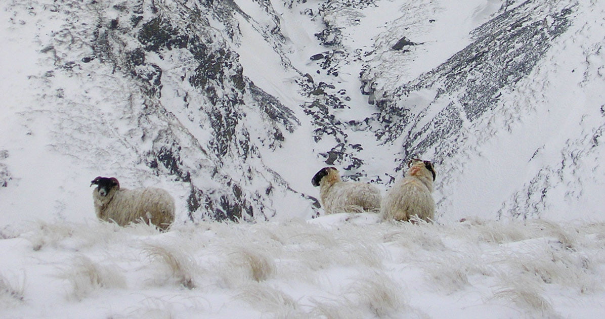
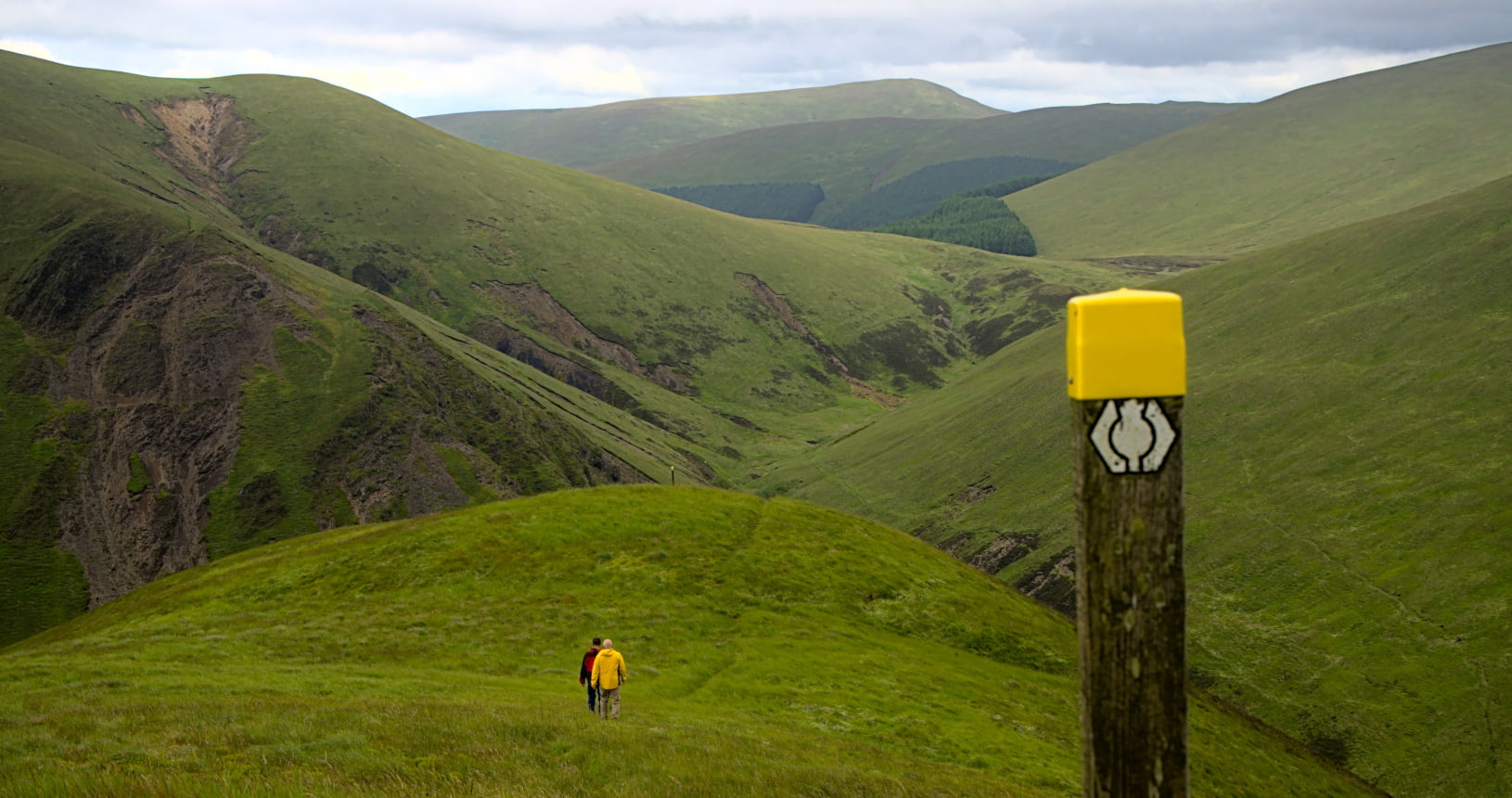
As the route climbs up out of the farmland and into forestry you have a choice. The high route takes you up to Croft head. Your reward for the very steep climb is the fantastic views as you go through the heather moorland on the top. Then down a steep and winding path down Cat’s Shoulder. The low route follows the forest road and then onto a path up into the top of the Whamphrey Glen.
The two routes join again as you start to climb up to Ettrick Head. This is the border between Dumfries and Galloway and the Scottish Borders. It is also the watershed of Scotland. Every drop of water that falls behind you will flow into the Atlantic, every drop that falls in front of you will flow into the North Sea.
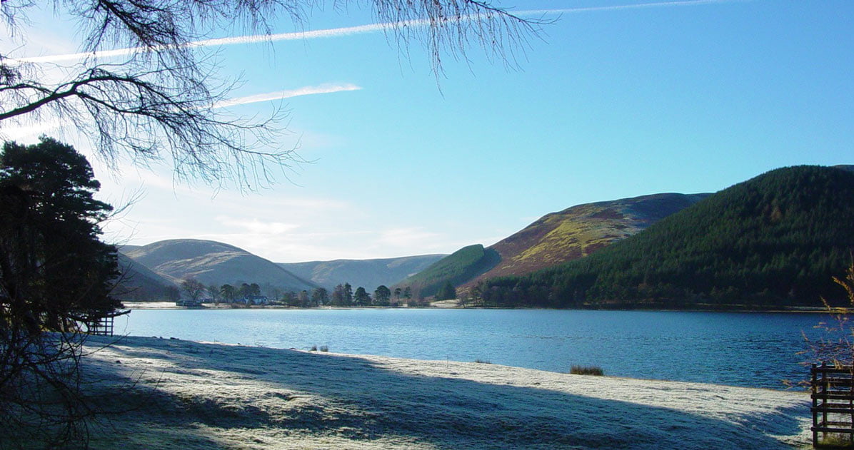
The path soon drops down again and heads into some forestry where you will find the Over Phawhope bothy. This can be a stopping point to break the route or a shelter while you eat some lunch. A quiet road then takes you down to Scabcleuch where you start the climb up and over to St Mary’s Loch. You come down from the hills between St Mary’s Loch and the smaller Loch of the Lowes. There is a campsite here and a cafe to enjoy a cup of tea overlooking the Loch.


Here in dear Scotland are mountains and glens.
Lone crofters cottages and wee but and bens.
We can ski down fine mountains all covered with snow.
Fish from the river in glens down below.
Brian W Hill
| Start | Beattock |
|---|---|
| Finish | St Mary’s Loch |
| OS Explorer Maps | 330 Moffat and St Mary’s Loch |
| Distance | 34km / 21miles |
| Height Range | 90 – 525m |
| Total Ascent | 820m |
| Information Shelter | Tibbie Shiels Inn (Inn currently closed, but camping nearby and Gordon Arms Pickup point at the Glen Cafe) |
| Supplies | There is a limited range of shops in Beattock, Moffat, 1.5 miles off route has many shops and eating places. St Marys loch has no shops but has an inn and a cafe. See Baggage transfer for details |
| Public Transport | Only available at the start and finish of this section. Beattock has a regular bus service to Dumfries. St Mary’s loch has a limited service. |
| Cycling | The whole of this section is suitable for mountain bikes. |

