
The Secrets of Old Kirkcolm Churchyard
April 19, 2022
Stories, Lights and E-bikes!
June 22, 2022
The Rhins of Galloway Coast Path is now taking shape with gates, fencing and bridges installed on many land holdings to increase accessibility.
There is a focus of activity currently on the North Rhins section of the route which is scheduled for completion in late Spring/early summer. A map of currently accessible sections of the path is shown below – with Green indicating accessible sections and Red those that are currently inaccessible. Much of the route follows designated core paths and route details can be found at DGC - Core Paths List (dumgal.gov.uk). Please note work is still being undertaken on some green sections, and directional route signage is not yet installed. The new coast core path improvement works, together with the established Mull of Galloway Trail between Stranraer and the Mull of Galloway, will form a continuous route around the peninsula.


Additional funding has been secured from the Coastal Communities Fund and the Agri Environment Climate Scheme for improvements at sections that had further deteriorated since the initial surveys were undertaken 6 years ago. Distinctive interpretation and signage for the route is also being developed and a sculptural feature is being considered to mark the start/end of the Rhins Coast Path in Stranraer.
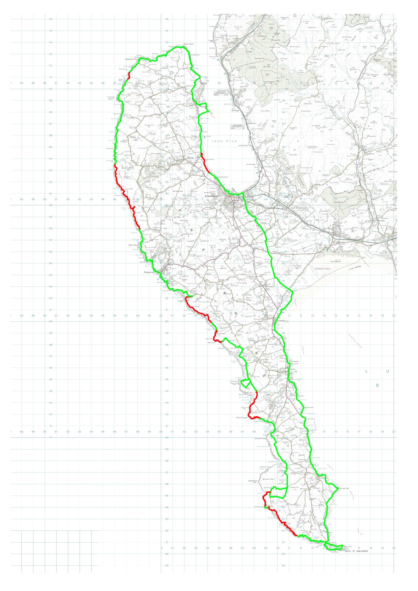
This map is reproduced from Ordnance Survey material with the permission of Ordnance Survey on behalf of the Controller of Her Majesty's Stationery Office © Crown Copyright. Unauthorised reproduction infringes Crown Copyright and may lead to prosecution or civil proceedings. LA 100016994 2022
© Crown Copyright. All rights reserved. Dumfries and Galloway Council 100016994 (2022)

