
Caves of Kilhern
July 26, 2022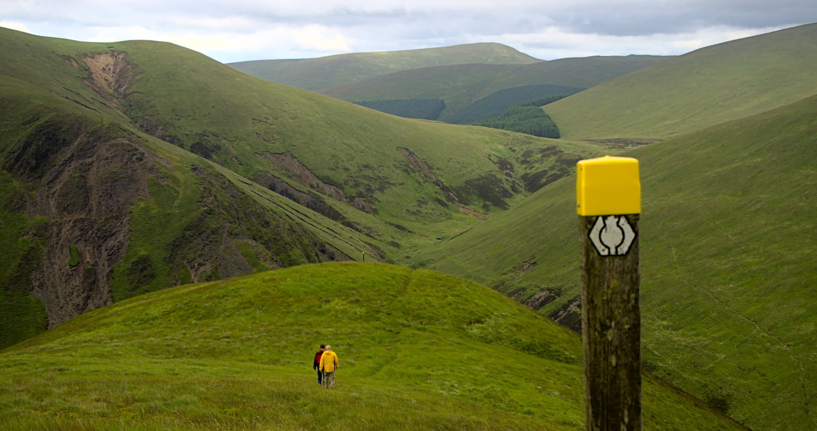
Croft Head
July 27, 2022
SHORT WALK
Lowther Hill
A steep climb to the highest point on the Southern Upland Way. From the summit of Lowther Hill you will get spectacular views across Southern Scotland.
The walk can be a return walk to the golf ball on the summit of Lowther Hill and back. Alternatively if you have two cars you can leave one at Over Fingland in the Dalveen Pass to make this a linear walk. The climb is steep in places but not too long and the views you get are worth the effort.
You will start in Wanlockhead, the highest village in Scotland. This area was once dominated by the lead mining industry. There is a museum here about it. You can go down one of the mines as well as into many of the historic buildings that were once a part of the mine.
This walk starts at the museum and you follow the Southern Upland Way through the village and out onto heather moorland. Keep an eye out for grouse and an ear open for the song of the skylark as you walk as both are common here.
As as you leave the village keep looking behind you to enjoy the amazing views. They will only get bigger and better the higher you go. The footpath winds through the moorland joining and crossing the road that goes to the top. This is a private road to the radar station but there is the occasional work vehicle and on good days a lot of cyclists so take care.
When you reach the top the golf ball towers over you. This is the Lowther Hill Radar Station which is used for air traffic control across Southern Scotland. It gives the summit a very different feel to any other on the route. The views here are something special as you are on the highest point of the Southern Upland Way. On a good day you will see the Striding Arches, Daer Reservoir, Criffel and the Lake District along with a good deal of the rest of Southern Scotland.
From here you can either return the way you came to Wanlockhead or you can continue along the Southern Upland Way to Over Fingland in the Dalveen Pass.


| Start | Wanlockhead Mining Museum |
|---|---|
| Finish | Return to Wanlockhead or carry on to Overfingland |
| OS Explorer Maps | Explorer 329, Lowther Hills, Sanquhar & Leadhills |
| Distance |
7 km / 4 miles return to Wanlockhead or |
| Height Range | 400 - 725m |
| Total Ascent | 325m |
| Information Shelter | There is an info panel at the museum at Wanlockhead |
| Supplies | Cafe at the museum |
| Public Transport | Regular bus service from Lanark or Sanquhar |
| Cycling |
The path is very steep and would be difficult for even the fittest cyclist. There is a private road to the radar station that is popular with road cyclists. |


